Wetland mapping and prioritisation for conservation
90% of freshwater wetlands have been lost in New Zealand, and the remaining ones continue to be threatened by human activities. To help protect them, we need an exhaustive inventory and a method to help allocate resources to the most valuable ones first. The EcoSat project has suggested a mapping method of wetlands.
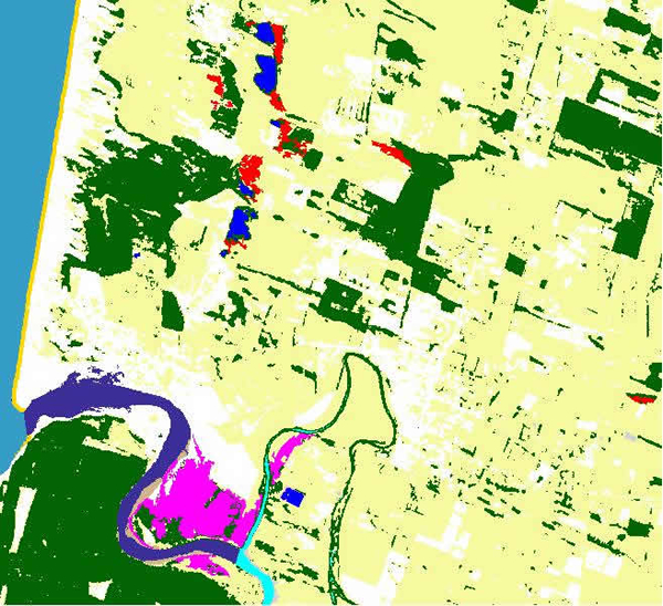
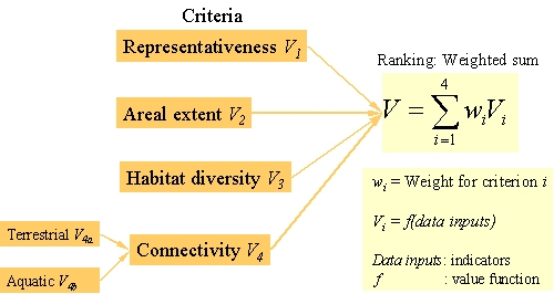
This project has now gone further by designing a protocol to rank palustrine or estuarine wetlands into priority order. This method uses landscape indicators derived from satellite images and other GIS layers. Global indicators are used (representativeness in LENZ domains, areal extent, habitat diversity, connectivity) and assigned a value to score wetland sites in the region. The calculation is based on a hierarchy of input parameters (e.g., surface in hectares; number of wetlands in the same buffer zone) that helps define each indicator. The score is then the result of a weighted additive function, which balances the relative importance of each indicator.
Protocol to rank palustrine or estuarine wetlands into priority order
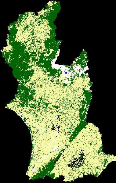
This process was applied to about 300 sites of palustrine or estuarine vegetation recorded in the Manawatu/Wanganui Region.
Although these indicators are only estimates of the biodiversity value of wetlands, they permit a regional ranking quickly and objectively. This ranking is an indicative tool for getting a first-cut ranking list and would need further in-field investigation to complete the ecological assessment.
This ecosat application has now been adopted in a major national project: Waters of National Importance (WONI). This project is led by Department of Conservation and focuses onwetlands, rivers and lakes. Landcare Research has been contracted to provide a national map and abiodiversity assessment of freshwater wetlands using the Ecosat methodology. A series of pressure indicators has then been developed, and used to generate a priority list ofwetlands at the national level.
The results of the WONI project are:
- A national map of current extent of freshwater wetlands
- Anational map of historic extent of freshwater wetlands
- A typology offreshwater wetlands
- A series ofpressure measures on each freshwater wetland
- A ranking list of freshwaterwetlands