ALOS
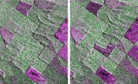
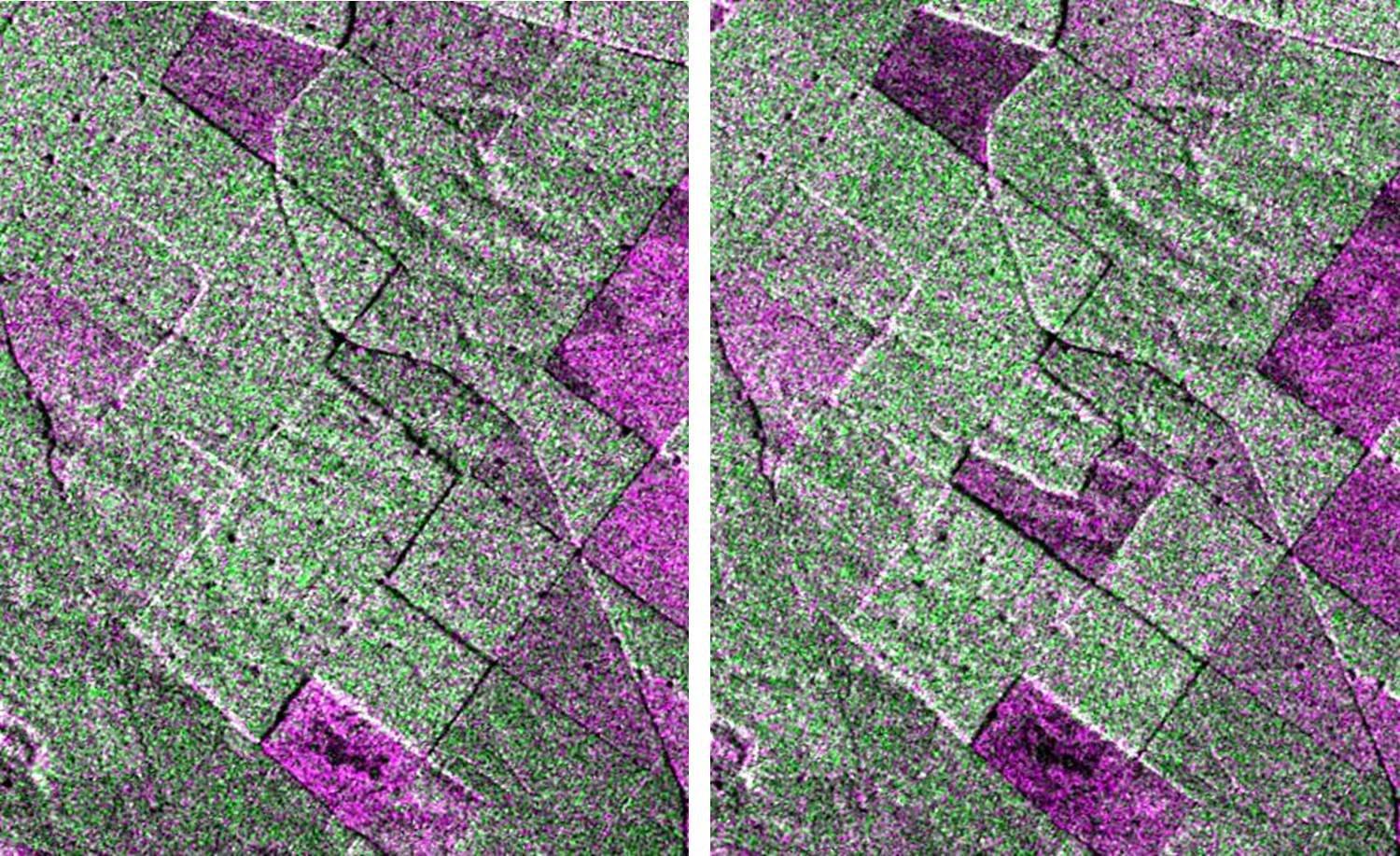
Forest change detection with PalSAR FBD. Pink areas are felled. Left image: 11July2009. Right image: 21 October 2009
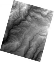
5-m central North Island DEM derived from PRISM tri-stereo imagery. JAXA retains ownership of ALOS data.

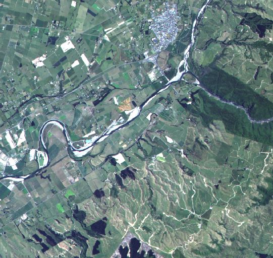
ALOS AVNIR natural colour subscene of Ashurst and the Manawatu River. JAXA retains ownership of ALOS data.

Description
Japanese satellite series carrying several sensors, typically both multispectral and microwave.
ALOS-1 had 3 sensors
· AVNIR-2 – Advanced visible and near infrared radiometer –4-band (blue, green. Red, NIR) multispectral scanner with 10m spatial resolution and a 70 km swath
· PRISM – Panchromatic remote sensing instrument for stereo mapping - panchromatic sensor with 2.5m spatial resolution collecting either along-track tri-stereo with a 35 km swath or images with a 70 km swath. Ideal for generation of medium resolution digital elevation models.
· PalSAR – Phased Array type L-band synthetic aperture radar with several viewing geometries and modes including single, dual, and quad-polarisation
ALOS-2 - launched May 2014 - has an L-band SAR similar to PalSAR on ALOS-1 but with improved spatial resolution, observable range, and a spotlight (very high resolution) mode.
ALOS-3 will carry AVNIR-3 a multispectral scanner with improved spatial resolution and repeat coverage plus an improved PRISM sensor with 0.8m spatial resolution and a hyperspectral sensor.
Availability
ALOS-1 imagery was collected on a pre-planned and published schedule. Programming will be more feasible with ALOS-2 and -3.
ALOS-1 operated from January 2006 to April 2011; ALOS-2 was launched in May 2014; ALOS-3 is due for launch in 2015.