TerraSar-X & TanDEM-X

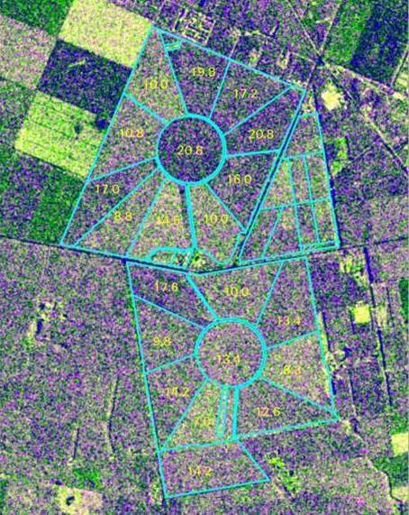
Calculating biomass on a dairy farm from TerraSAR-X FBD imagery. (c) DLR.

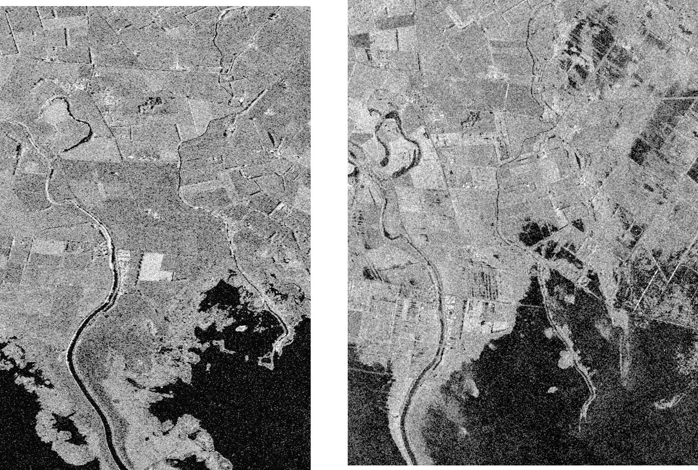
Flood inundation around Lake Ellesmere 4 August2008 with 14 May 1988 imagery, on the left, for comparison. (c) DLR
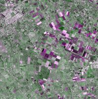
Part of a TerraSAR-X strip map image of the central Canterbury Plains. (c) DLR.
Description
Satellite series carrying X-band synthetic aperture radar sensors capturing imagery in a number of modes from ScanSAR (270km swath and 40m nominal spatial resolution) to Spotlight (4km swath and 0.25m spatial resolution) with most modes also available as either single or dual-polarisation. Operating in a twin satellite formation about 500m apart, TerraSAR-X and TanDEM-X are collecting interferometric imagery for the creation of a quality global DEM.Availability
Imagery can be programmed on demand.
TerraSAR-X was launched in June 2007 and was joined by TanDEM-X in June 2010.