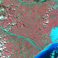
Gallery of satellite images
Here is a selection of satellite images from various sensors.
SPOT-5 K439 J438. Canterbury Plains. 15 October 2005. © CNES 2005

SPOT-5 subscene in standard false colours. A small town on the Canterbury Plains. © CNES 2005.

JERS-1 SAR.Taranaki . Path 629 Row 366. 3 February 1994. NASDA/MITI retains ownership of copyright.

Landsat-7 ETM+. Wellington/Manawatu. Path 72 Row 88. 4 December 2000.

Landsat-7 ETM+. Nelson. Path 74 Row 89. 20 February 2001.

Landsat-7 ETM+. Marlborough. Path 73 Row 88 s.a.t. south. 30 December 2001.

JERS-1 SAR. North Canterbury. Path 630 Row 373. 29 August 1975. NASDA/MITI retains ownership of copyright.

JERS-1 SAR. Christchurch/Rakaia. Path 630 Row 374. 3 February 1994. NASDA/MITI retains ownership of copyright.

SPOT panchromatic image, K38 J557, Antarctica 14 January 1990 © CNES 1990

SPOT-3 panchromatic imagery, K443 J433 Wellington 22 November 1995 © CNES 1995.

SPOT-3 panchromatic imagery.K141 J273. North-west Iran 23 September 1994 © CNES 1994

Landsat-2. Taranaki. Path 73 Row 87. 30 January 1974.

Landsat-2. Volcanic Plateau. Path 72 Row 87. 22 December 1975.

Landsat-2. Central South Island. Path 75 Row 91. 6 February 1978.

Subscene of RADARSAT standard beam data showing an ice tongue in Ross Dependency, Antarctica. C. CSA 1997.

Subscene of RADARSAT standard beam data showing Piako River emptying into Hauraki Gulf, North Island, New Zealand. C. CSA 1999.

Subscene of RADARSAT standard beam data showing wind, wind shadow, wave, and current structures in the sea off Cape Egmont, North Island, New Zealand. C.CSA 1999.

Landsat-5. Otago-Southland. Path 75 Row 92. Bands 1,2,3. 15 April 1989.

TM 14. Waikato-Taranaki. Path 73 Row 87. Bands 2,3,4. 4 June 1989.

TM 23. Rakaia-Central Canterbury. Quarter scene from Path 74 Row 90. Bands 2,5,7. 16 October 2003.

SPOT-5 large subscene from K442 J430. Wanganui/Waitotara. 9 March 2004. © CNES 2004.

SPOT-4 multispecteal image of Auckland, 3 April 1999. © CNES 1999

SPOT-1 image of Mt Cook K 435 J438 23 February 1987 © CNES 1987

SPOT-4 multispectral image of Banks Peninsula. 1 June 1998. © CNES 1998.

SPOT-1 multispectral image of the Marlborough Sounds, 30 March 1988 © CNES 1988

SPOT-4 multispectral image of southern Wairarapa, 29 March 1999 © CNES 1999

Typical NOAA image of New Zealand

ALOS PalSAR image of the central North Island. METI/JAXA retains ownership of ALOS data.

GeoEye pan-sharpened natural colour imagery. (c) Geoeye 2010.

Standard false colour image of The Cake Tin (sports stadium), Wellington. This is a mid-winter image, hence the strong shadowing. (c) CNES 2012.

Natural colour image of Bora Bora, French Polynesia. (c) CNES.

Part of a TerraSAR-X strip map image of the central Canterbury Plains. (c) DLR.

An small islet in the Bounty Island group. Quickbird imagery (c) DigitalGlobe.

Forest change detection with PalSAR FBD. Pink areas are felled. Left image: 11July2009. Right image: 21 October 2009

Natural colour multispectral imagery of Wellington airport. (c) CNES 2012

Panchromatic imagery of Royal Port Nicholson Yacht Club, Wellington. (c) CNES 2012

Calculating biomass on a dairy farm from TerraSAR-X FBD imagery. (c) DLR.

Flood inundation around Lake Ellesmere 4 August2008 with 14 May 1988 imagery, on the left, for comparison. (c) DLR

5-m central North Island DEM derived from PRISM tri-stereo imagery. JAXA retains ownership of ALOS data.

With SPOT-6 and -7, plus the Pleiades satellites,more than daily image acquisition is available.

ALOS AVNIR natural colour subscene of Ashurst and the Manawatu River. JAXA retains ownership of ALOS data.

One of the more cloud-free NOAA images of 2012

A relatively cloud-free NOAA image in 2009.

Silt-laden waters flooding Christchurch streets hours after the 4 September 2010 earthquake. Image (c) Geoeye 2010.

Landsat-8 imagery of Otago, February 2013.

Landsat-8 image of the Waikato, February 2014

Flowering gorse shows up well in a Geoeye image of Chatham Island. This is part of a semi-national high resolution dataset acquired by the KiwImage consortium.

Mapping damage from Cyclone Bola. Silt (orange) and landsliding (yellow) in a valley near Gisborne mapped from SPOT imagery.

SPOT-5 image of North Canterbury. (c) CNES 2013.

SPOT-5 image of inland Canterbury taken on 7 June 2012 after a big snowfall. (c) CNES 2012.

SPOT-5 imagery of central Southland after snow on 12 July 2013. (c) CNES 2013.

Radar image of the Tongariro area taken by the NASA/JPL AirSAR instrument in November 1995.

ALOS AVNIR imagery of Antarctica Dry Valleys. JAXA retains ownership of ALOS data.

ALOS PRISM image of Hagley Park, Christchurch, December 200. JAXA retains ownership of ALOS data.

ALOS PRISM image of Karioi Forest and the flanks of Ruapehu, December 2009. JAXA retains ownership of ALOS data.

ALOS PRISM image of the lower reaches of Wanganui River, December 2009. JAXA retains ownership of ALOS data

SPOT-2 image of Auckland Islands. (c) CNES 2001.

Landsat-7 ETM+ image of the Alpine Fault.

An iceberg a little south of Stewart Island picked up by a MODIS AQUA image.

MODIS TERRA image over Canterbury showing a jet trail. 15 December 2006.

MODIS TERRA image of New Zealand, January 2009.

SPOT-3 multispectral image of part of North Vietnam. (c) CNES 1996.

MODIS TERRA image of the South Island after June 2006 snowfall.

Perspective view of Wellington derived from SPOT imagery. (c) CNES 1989.
