SPOT
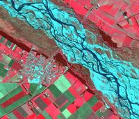
SPOT-5 subscene in standard false colours. A small town on the Canterbury Plains. © CNES 2005.

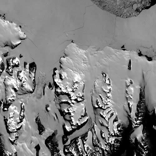
SPOT panchromatic image, K38 J557, Antarctica 14 January 1990 © CNES 1990

Description
French satellite series collecting images with a 60-80km swath width and a 26-day repeat cycle for nadir viewing. With pointing capabilities there are around 11 viewing opportunities every 26 days over New Zealand.Twin sensors allow collection of 120km wide areas or for acquisition of simultaneous multispectral and panchromatic imagery.
The early SPOT satellites had 3 multispectral bands at 20m spatial resolution and a panchromatic band at 10m; SPOT-4 added a SWIR band; with SPOT-5, the spatial resolution improved to 10m multispectral and 5m panchromatic, plus the capability to superresolve to 2.5m.
Availability
SPOT can be programmed to collect imagery on demand.
SPOT-1 operated from February 1986 to December 1990; SPOT-2 from January 1990 to July 1999, SPOT-3 from September 1993 to November 1996, and SPOT-4 from March 1998 to July 2013. SPOT-5 was launched in May 2002 and is operational.
Uses
Mapping and monitoring for a variety of applications.
SPOT-5 super-resolved imagery has been used to create a 2.5m seamless global true colour basemap offering high geometric accuracy. This SPOTMaps product is available nationally, regionally, and as single tiles.