How to tell our wetlands from our drylands … the wetland delineation tool
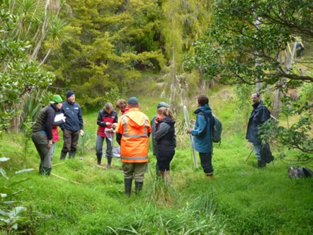
Bev Clarkson (blue parka; 2nd from right) leading a wetland delineation workshop.
Bev Clarkson
More than 90% of New Zealand’s wetland area has been lost in the last 150 years, one of the highest rates of loss in the world. Our remaining wetlands and the services they provide are under pressure from drainage, nutrient enrichment, invasive plants and animals, and encroachment from urban and agricultural development.
Confusion under the RMA
The Resource Management Act (RMA) seeks to give remaining wetlands a measure of protection. It defines wetlands as including ‘permanently or intermittently wet areas, shallow water, and land water margins that support a natural ecosystem of plants and animals that are adapted to wet conditions’. However, this definition is broad and difficult to apply consistently in the field. The inability to define precisely whether a site is a wetland or not, and where a wetland starts and finishes has led to confusion by regulatory authorities, landowners and the public alike.
Wetlands expertise
Landcare Research has a well-established reputation in wetland ecology, management and restoration (a complex undertaking because of the many interacting physical, chemical and biological processes). Because of this, Meridian Energy contacted us wanting help to define wetlands ‘on the ground’ – important for their resource consent processes. This need aligned strongly to our MBIE contestable-funded Restoring wetlands programme. A co-funded project was set up to develop a system that would assist all stakeholders with identifying and delineating wetlands.
 Developing a new delineation system
Prerequisites for the new national system or tool were that it needed to be robust and defensible in resource consents, council hearings and in the Environment Court and be of use to wetland owners and managers.
The tool is adapted for New Zealand from the USA Federal Wetland Delineation System for regulatory purposes (Environmental Laboratory 1987), which is based on vegetation, hydrology and soils. For New Zealand, we found that a vegetation-based tool provided reliable information in nearly all situations. However, where vegetation-only assessments would be inconclusive or misleading (e.g. vegetation-sparse mudflats or ephemeral wetlands), where vegetation has been severely disturbed (e.g. after a fire or cut-over peat bogs), or in drier areas (e.g. some gumlands and pakihi), additional assessments of soils and hydrology (as in the USA system) are recommended.
To develop the New Zealand-specific tool, a team of scientists from Landcare Research, NIWA, DOC, Wildland Consultants and Northland Regional Council classified nearly 1000 native and exotic plant species according to their fidelity to wetlands and expected prevalence:
- obligate wetland (OBL: occurs almost always in wetlands; estimated probability >99% occurrence in wetlands)
- facultative wetland (FACW: occurs usually in wetlands; estimated probability 67–99% occurrence in wetlands)
- facultative (FAC: equally likely in wetlands and non-wetlands; estimated probability 34–66% occurrence in wetlands)
- facultative upland (FACU: usually in non-wetlands; estimated probability 1–33% occurrence in wetlands)
- obligate upland (UPL: almost always in non-wetlands; estimated probability <1% occurrence in wetlands)
As well as the wetland indicator status ratings of species present, the tool also incorporates protocols for measuring species dominance and abundance. The technical guidelines for sampling procedures, protocols, checklists and field sheets were then trialled in the field, and proved to be effective in identifying wetlands and delineating their boundaries.
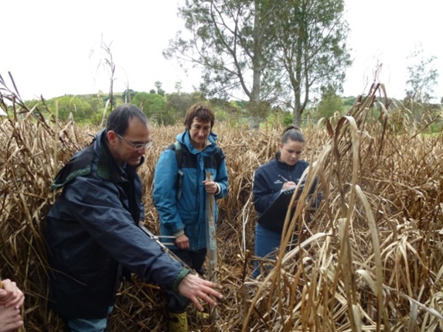
Training workshops and advice have been delivered to Auckland Council, Taranaki Regional Council, Hawke’s Bay Regional Council and Tasman District Council. Wetlands are culturally significant areas for iwi and contain a wealth of resources ‒ the tool will be useful to iwi in defining priority wetland areas for planning, protection and restoration.
Uptake and use
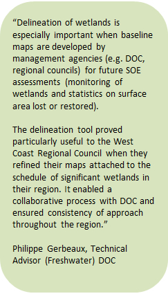
 The tool has been accepted by DOC and Environment Canterbury in hearing processes, and has been incorporated into planning documents. Northland Regional Council has used it to ensure protection of areas delineated as wetlands in consents for the development of gumlands.
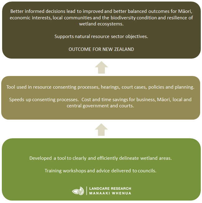
The new delineation tool’s robust evidence-based approach speeds up resource consent processes. It saves costly legal and consultancy fees for all parties by providing a standard national approach for hearings, court cases, policy, and planning.
Key collaborators
- NIWA
- Department of Conservation
- Northland Regional Council